
Up Pen-y-ghent from Helwith Bridge
Located in United Kingdom
Heading anti-clockwise around Pen-y-ghent before heading up to the summit from the north. We descend the same way, down the main trail.
Surface type: 39% gravel / back lanes 35% mud / grass 26% road
Traffic levels: 100% Quiet roads
28km long 839 metres of climbing 3hrs06 at 9.0kmh-
A few obstacles lay in the way 15 km from start 436m above sea level 1hrs40 at 8.9kmh Looking north-east
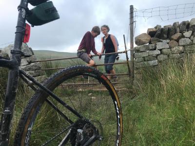
-
Slow progress up this path 18 km from start 438m above sea level 2hrs04 at 8.7kmh Looking east
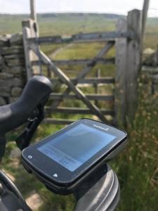
-
A grassy route to the summit This is a start of climb 18 km from start 496m above sea level 2hrs04 at 8.7kmh This path up really isn't suitable for cycling, so you may want to continue along to the main path (the one you descend later on).
-
The steps are really too large to descend down This is a descent (take care) 20 km from start 602m above sea level 2hrs25 at 8.3kmh
Download: Route card
Packages:
